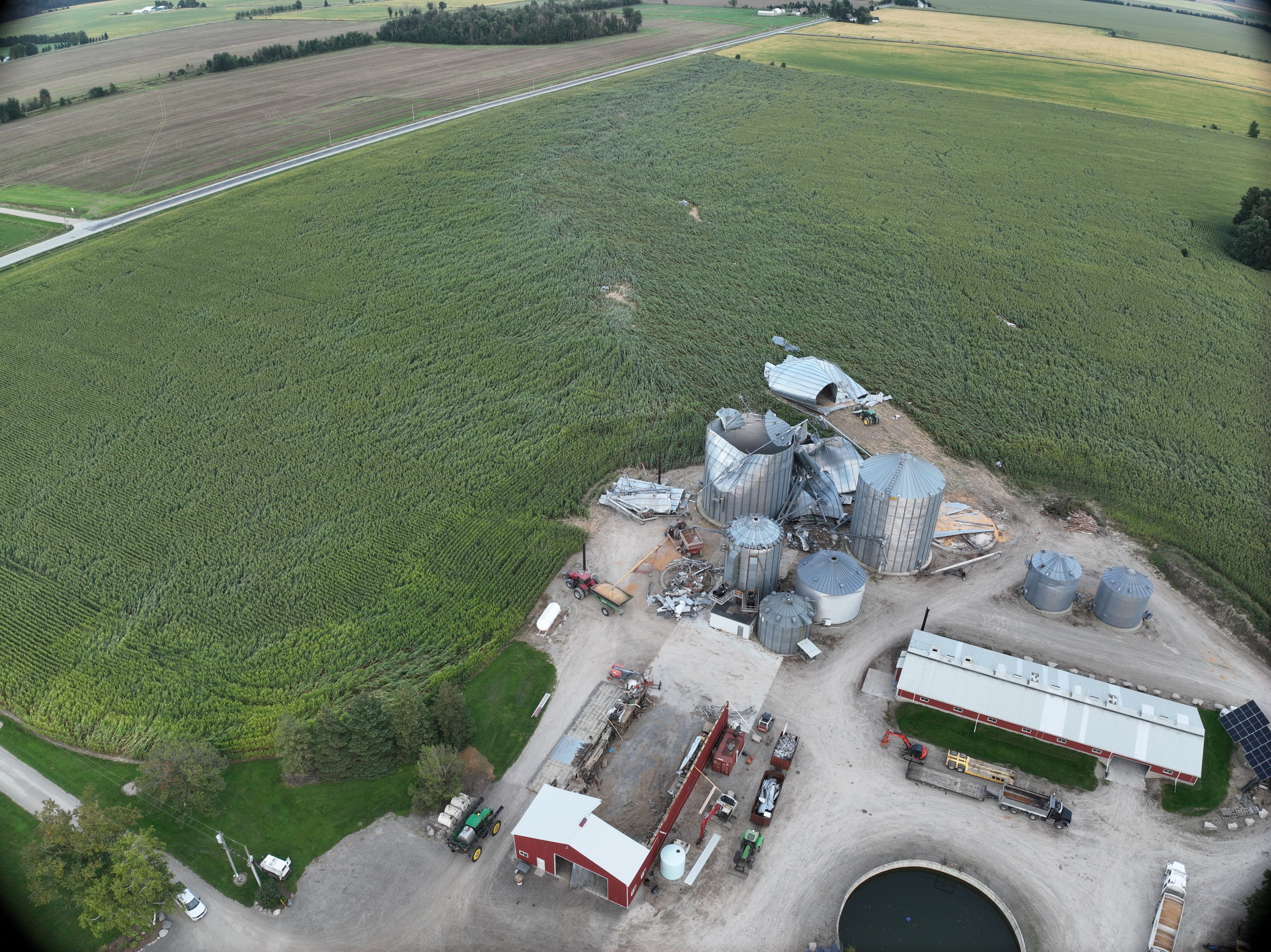
“Drone photo of the worst damage point west of Monkton, showing a partially destroyed farm building, several destroyed grain bins, and a tornado path through the crops.” | NTP