STORM REPORT – Back on Sept. 2 conditions in Southern Ontario were ripe for a chain of storms; various weather networks were indicating the first week of September would be hot and humid much like the tail-end of summer.
The first three days of the month saw a humidex value exceeding 30, with Sept. 1 and Sept. 2 peaking near 40.
Combined with a cold front heading East from Michigan, Southern Ontario had its own temporary tornado alley.
Confirmed by the Northern Tornadoes Project (NTP), based out of Western University, four tornadoes touched down West of Kitchener/Waterloo on Sept. 2, 2026, accompanied by four separate downbursts.
There were also reports of a tornado in Guelph, though NTP director David Sills said the images circulating online were likely fakes.
However, Guelph still received its share of mother nature’s brutish thundershowers.
Historical climate data from Environment Canada indicates Guelph received over 40mm of rainfall within two hours; low-lying streets were flooded over and trees were swinging with the wind.
In those affected areas by Kitchener, NTP is certain four tornadoes touched down on September 2, as highlighted in their online blog.
The first was in Monkton, documented at 5:06 p.m., hitting a mark of one on the Enhanced Fujita (EF) scale.
The EF scale is the modern framework used to determine tornado severity based on wind speeds and that EF1 Monkton tornado reached peak wind speeds of roughly 150 kph.
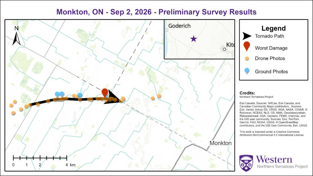
Survey map for the Monkton EF1 tornado | NTP
It had a track length of 4.91 kilometres, a maximum path width of 50 metres and caused some damage to grain bins, trees and crops in the area.
-
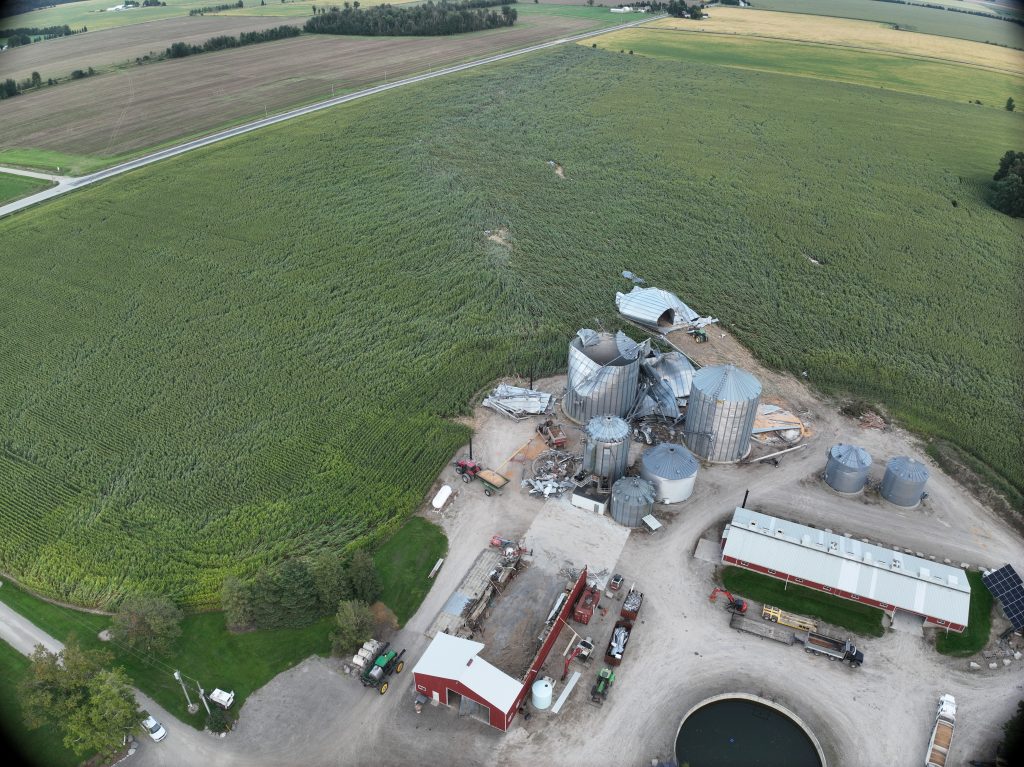
- “Drone photo of the worst damage point west of Monkton, showing a partially destroyed farm building, several destroyed grain bins, and a tornado path through the crops.” | NTP
-

- “Ground photo of the partially destroyed farm building shown previously.” | NTP
-
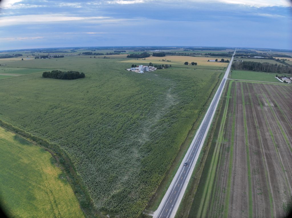
- “Drone photo looking west along the tornado path through the crops at the end of the damage track, just after the worst damaged property.” | NTP
Less than 20 minutes later a tornado in Tavistock was documented at 5:23 p.m., hitting a mark of zero on the EF scale.
Despite a rating of EF0 that Tavistock tornado still reached peak wind speeds of around 125 kph; it had a track length of 6.24 kilometres, a maximum path width of 410 metres and caused some light roof damage in the area.
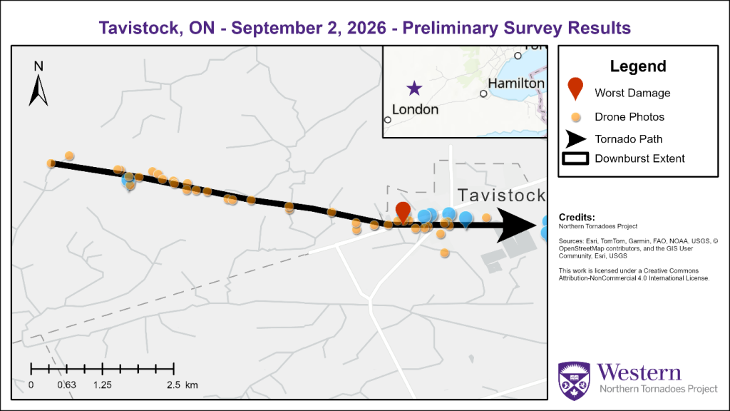
Survey map showing the EF0 tornado tracking from the west into Tavistock | NTP
There was also a downburst in the Tavistock area with an estimated maximum wind speed of 125 kph; NTP said a downburst is an intense downdraft of wind formed during thunderstorms and are strong enough to cause surface damage and alter aircraft altitude.
-
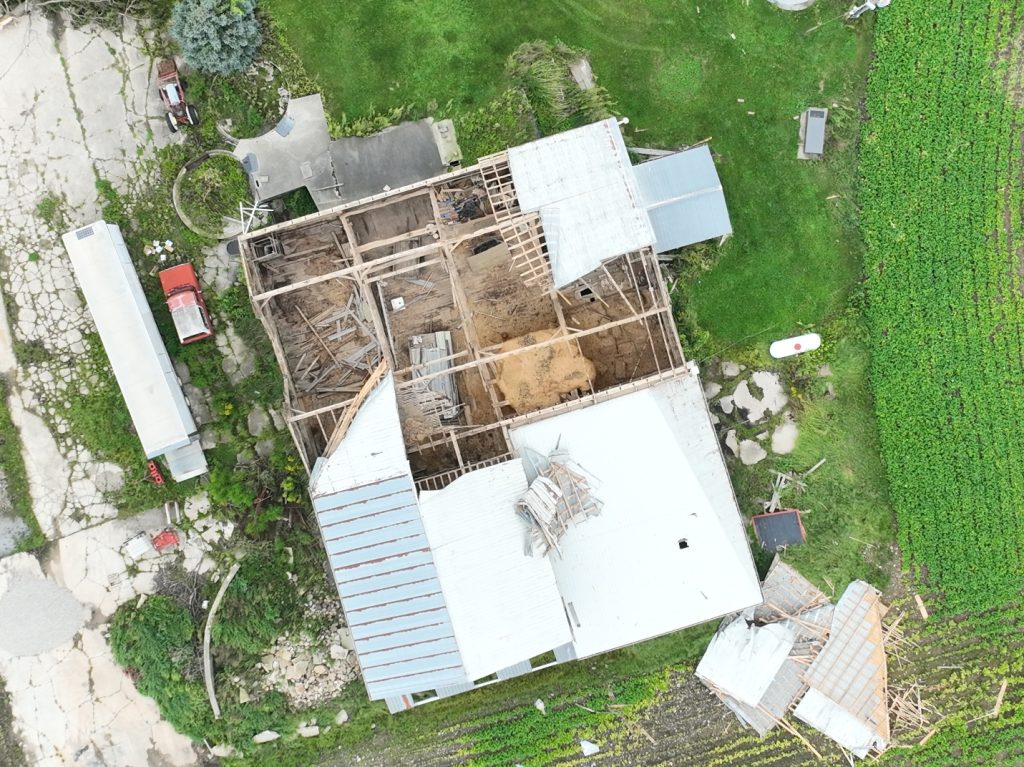
- Tavistock downburst damage | NTP
-
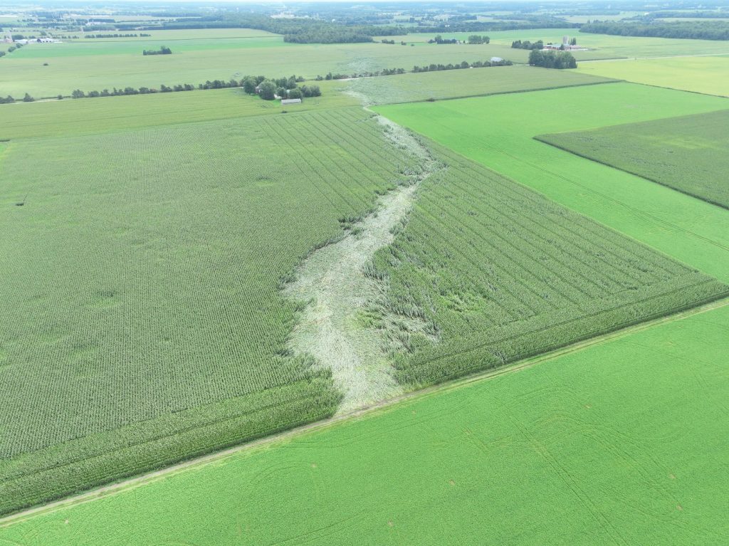
- “Drone photo of the path of the EF0 tornado clearly seen through crop lodging west of Tavistock.” | NTP
A couple minutes later a third tornado was recorded north of Tavistock by a community called Shakespeare, roughly 10 kilometres from the Tavistock tornado.
The Shakespeare EF1 tornado had an estimated maximum wind speed of 155 kph, a track length of 8.29 kilometres and a maximum path width of 420 metres.
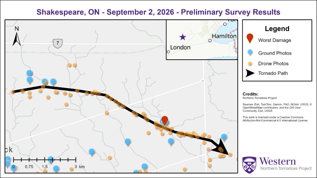
Survey map showing the EF1 tornado starting North of Tavistock and tracking to the southeast | NTP
The NTP blog reports extensive damage to multiple structures in the affected area, including a destroyed barn, along with damaged power lines, trees and crop fields.
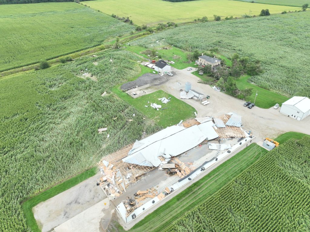
“Drone photo of EF1 tornado damage to a barn roof, with tree and crop damage as well.” | NTP
And then on September 9, NTP confirmed a fourth tornado in the area.
This EF1 tornado was recorded close to Wellesley at around 5:25 p.m., about 30 kilometres West of Kitchener.
NTP surveyors estimate a maximum wind speed of about 145 kph, a track length of 6.11 kilometres and a maximum path width of 490 metres.
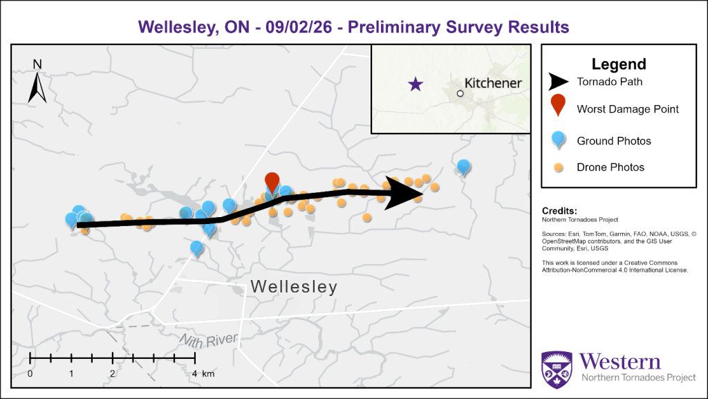
Survey map showing the track of the Wellesley EF1 tornado | NTP
Damage was reported to trees, power lines, a fabric structure and winds were strong enough to move a refrigerated trailer.
-
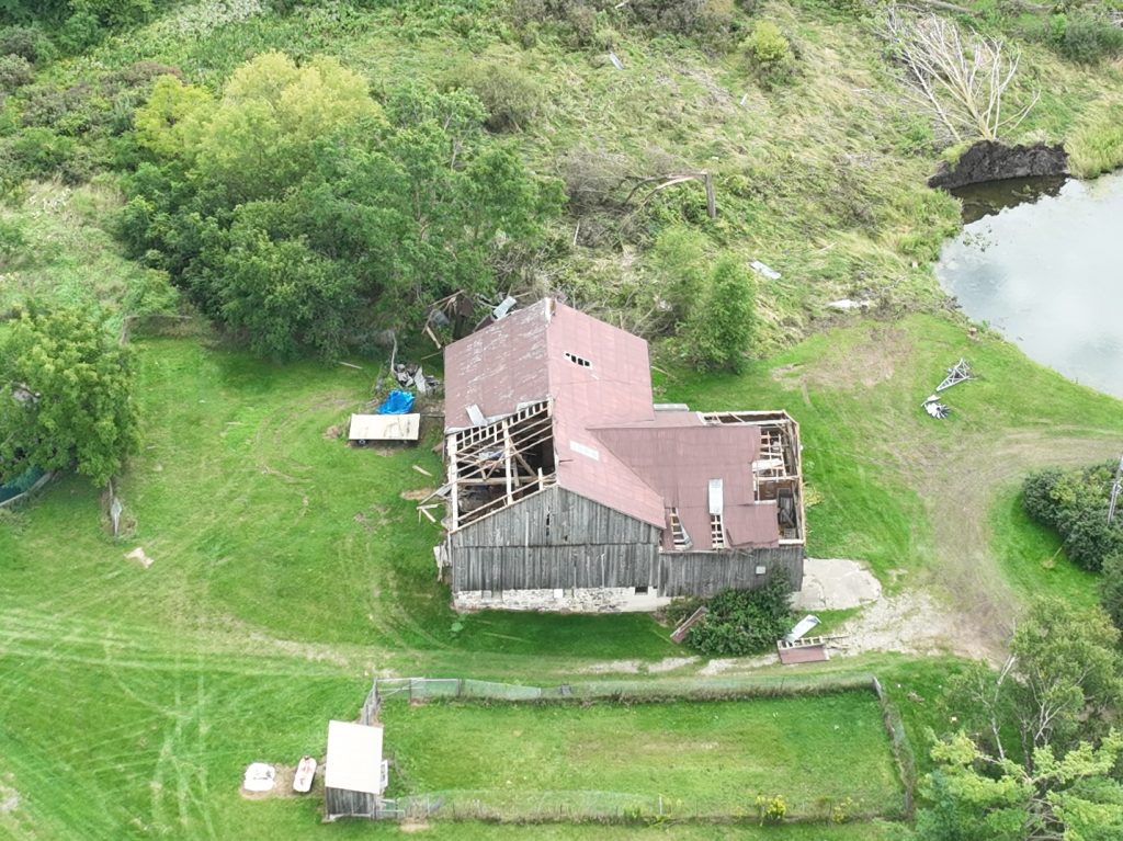
- “Drone photo of a barn missing parts of its roof and some tree damage on Weimar Line, the location of worst damage.” | NTP
-
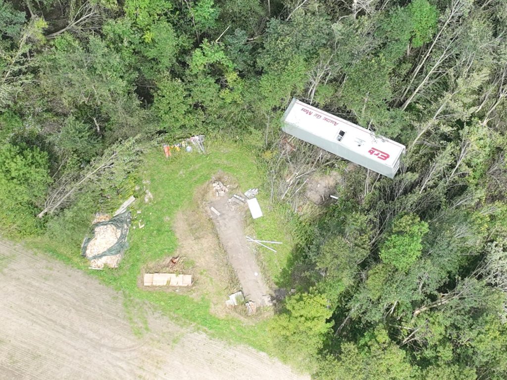
- “Drone photo of a converted refrigeration trailer moved off its foundation.” | NTP
Another downburst was recorded, this time in Seaforth, Ont., with maximum wind speeds of around 165 kph and caused damage to telephone poles, local homes and farm buildings.
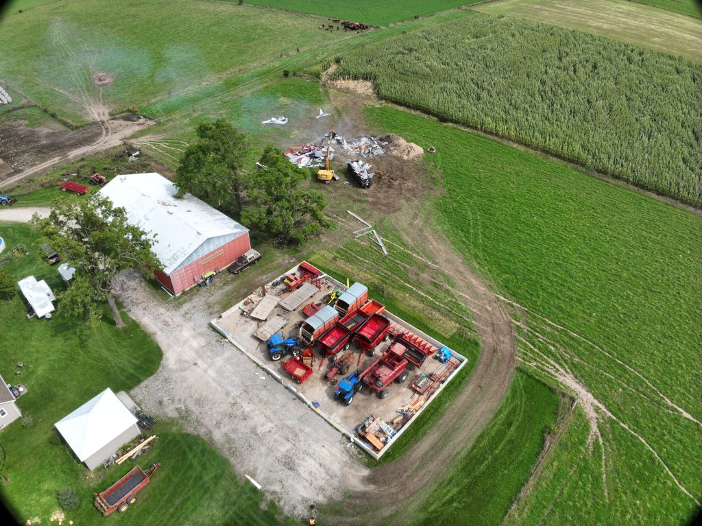
“Drone photo of a farm building that was destroyed near Seaforth. Note that the debris has mostly been cleaned up.” | NTP
Then a downburst was confirmed in Brodhagen; wind speeds topped out at about 155 kph, covering an area of about 23 kilometres long by eight kilometres wide and caused damage to power poles, crops and farm buildings.
NTP have reported farm outbuildings and grain bins were destroyed, with additional damage reported at some local homes.
-
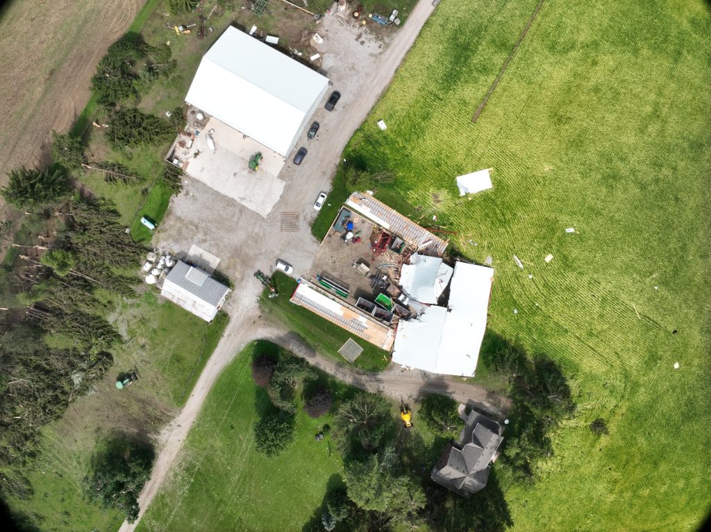
- Nadir drone photo showing damage within the extent of the Brodhagen downburst. | NTP
-
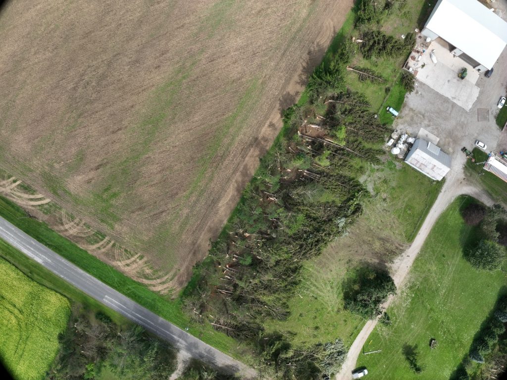
- Nadir drone photo displaying unidirectional tree damage caused by the Brodhagen downburst. | NTP
On Sept. 23, NTP confirmed a fourth downburst on the storm day of Sept. 2.
This event was recorded in Plattsville at around 5:35 p.m. with a top wind speed of 125 kph and affected an area about 5.1 kilometres long by 1.9 kilometres wide, causing damage to local power poles.
As of Oct. 1, 2026, 32 tornadoes have been recorded in the province of Ontario with half of those (16) being situated in the peninsula, West of Toronto.
No storm-related injuries were reported on September 2 across all tornado events recorded by NTP.
The following day, September 3, NTP said two tornadoes and a downburst made contact by Windsor and Wheatley with a third tornado later reported at River Canard.